This post is very long and will not show in its entirety via email. I recommend clicking through to the website for the best experience.
We’ve all been there. You’re at home over winter break watching some Mountain West action when your dad comes into the living room, looks at the TV, and proudly retorts:
“Boise State? San Diego State? Neither of those are states!”
Your dad doesn’t follow college sports, so he genuinely believes that he is the first person ever to point this out to you. He expects you to laugh at his acerbic wit. You give him a pity chuckle.
Here’s the thing, though: your dad is wrong.
Boise is a state and so is San Diego, along with Norfolk, Murray, Kennesaw, and every other school named like them. In fact, they’re the only real states; those Fifty Nifty United States you learned in elementary school history class are all posers.
Don’t believe me? Well, congrats on not being so easily convinced by a stranger’s nonsensical ramblings! But let me prove it.
These are the Secret States of America.
Finding the Secret States
First, let’s take every NCAA Division I institution with the full word “State” in the name, ignoring those whose only other geographic identifier is one of the 50 U.S. states because, remember, they’re posers. I’ll include every school whose name also lists a city or a region.
Alcorn State University
Appalachian State University
Austin Peay State University
Ball State University
Boise State University
Bowling Green State University
California State University, Bakersfield
California State University, Fresno
California State University, Fullerton
California State University, Long Beach
California State University, Northridge
California State University, Sacramento
Central Connecticut State University
Chicago State University
Cleveland State University
Coppin State University
East Tennessee State University
Grambling State University
Jackson State University
Jacksonville State University
Kennesaw State University
Kent State University
McNeese State University
Middle Tennessee State University
Mississippi Valley State University
Morehead State University
Morgan State University
Murray State University
Nicholls State University
Norfolk State University
Northwestern State University of Louisiana
Oklahoma State University–Stillwater
Portland State University
Sam Houston State University
San Diego State University
San José State University
Southeast Missouri State University
State University of New York at Albany
State University of New York at Binghamton
State University of New York at Buffalo
State University of New York at Stony Brook
Stephen F. Austin State University
Tarleton State University
Weber State University
Wichita State University
Wright State University
Youngstown State University
This is 47 schools, not nearly all of which are Secret States. I start with such a broad list because the first time I did this back in 2018, I got a bunch of angry comments from Stephen F. Austin and Austin Peay fans telling me that they should have been listed because their school name has “State” in it.
The reason why they weren’t should be evident if you read that last sentence closely. I’m not using full official university names in this exercise; I’m using athletic branding. After all, that’s what your dad would see on the TV screen when he walked into the living room, and that’s the point of this exercise.
So let’s look again at that list of 47. Some of them can be dismissed out of hand: Oklahoma State–Stillwater is just the poser Oklahoma State hiding behind a city name, while Albany, Binghamton, Buffalo, and Stony Brook are all part of the SUNY system but almost never use it in branding, let alone the word “State” on its own.
We can also get rid of a few poser states hiding behind directional or regional identifiers: Central Connecticut, East Tennessee, Middle Tennessee, and Southeast Missouri.
Here’s every other school on the list, with their official athletic branding alongside their name in parentheses:
Alcorn State University (Alcorn State)
Appalachian State University (Appalachian State)
Austin Peay State University (Austin Peay)
Ball State University (Ball State)
Boise State University (Boise State)
Bowling Green State University (Bowling Green)
California State University, Bakersfield (CSU Bakersfield)
California State University, Fresno (Fresno State)
California State University, Fullerton (Cal State Fullerton)
California State University, Long Beach (Long Beach State)
California State University, Northridge (CSUN)
California State University, Sacramento (Sacramento State)
Chicago State University (Chicago State)
Cleveland State University (Cleveland State)
Coppin State University (Coppin State)
Grambling State University (Grambling State)
Jackson State University (Jackson State)
Jacksonville State University (Jacksonville State)
Kennesaw State University (Kennesaw State)
Kent State University (Kent State)
McNeese State University (McNeese)
Mississippi Valley State University (Mississippi Valley State)
Morehead State University (Morehead State)
Morgan State University (Morgan State)
Murray State University (Murray State)
Nicholls State University (Nicholls)
Norfolk State University (Norfolk State)
Northwestern State University of Louisiana (Northwestern State)
Portland State University (Portland State)
Sam Houston State University (Sam Houston)
San Diego State University (San Diego State)
San José State University (San José State)
Stephen F. Austin State University (Stephen F. Austin)
Tarleton State University (Tarleton)
Weber State University (Weber State)
Wichita State University (Wichita State)
Wright State University (Wright State)
Youngstown State University (Youngstown State)
We can first eliminate poser California schools CSU Bakersfield, Cal State Fullerton, and CSUN. After that, we just get rid of every team without “State” in the name and that’s that.
Before I proceed, I’ll explain the edge cases so there’s no ambiguity whatsoever.
Alcorn State: They seem to be stuck between using “Alcorn” or “Alcorn State” for branding purposes. The former is more common but the latter still exists, including on official social media accounts, and I figure that’s enough to count ‘em.
Austin Peay: They’re often referred to as APSU in the academic sense, but never as “Austin Peay State” in athletics.
Bowling Green: Same situation as Austin Peay, really. They’ve had “BGSU” athletic logos in the past, but they don’t today, and they’re still never called “Bowling Green State”.
Grambling State: It’s the same scenario as Alcorn State to a lesser extent. “Grambling” and “Grambling State” are used somewhat interchangeably, but if it’s used in any official capacity, I’m counting it.
McNeese: They used to go by “McNeese State” but do no longer. Anyone still calling them McNeese State is simply wrong.
Mississippi Valley State: “Mississippi” here refers to the mighty river and not the poser U.S. state. It counts.
Nicholls: See McNeese.
Northwestern State: You might say this doesn’t count because it’s logically meant to be “Northwestern Louisiana State”, but you wouldn’t know that if you were a casual fan who heard the name “Northwestern State” out of context. Mostly, you’d think someone was talking about Northwestern. That’s what I did in my casual phase, anyway.
Sam Houston: They were a Secret State when I originally did this, but are no longer; they officially removed “State” from their athletic branding in 2020.
Tarleton: People still mostly call them “Tarleton State” despite all of their branding being “Tarleton”. Not sure why, but I’m not counting them.
I wouldn’t fault you for disagreeing with some of these, but I’ve shown my work. If you think Alcorn State or Grambling State or whoever should(n’t) count, let’s just call it disputed territory and move on.
Disputed territory on what, exactly? Why, the map, of course.
The Map
Here are the 28 Secret States of America.
You might be familiar with Joey Loose’s map of the closest D1 institution to every county1 in the United States. This map uses the same rules: it's the closest Secret State school to every county, measured at their geographic midpoints.2 For example, the geographic center of every county in Appalachian is closer to Appalachian State University than any of the other Secret State schools.
If you’re looking closely at the Eastern Seaboard, you might notice a little pink notch between Coppin and Morgan. That’s Baltimore, a consolidated city-county and the only county in the country that has two Secret State institutions within its limits. Coppin State is closer to the midpoint, but it didn’t seem fair to Morgan State that they couldn’t even hold down their own county. So, in the spirit of the real-life United States, I have decided that Baltimore is the capital of the Secret States and neither Coppin nor Morgan gets it.
If you’ve read this far, you probably want to know more about each of these states: population figures, D1 schools, maybe even political leanings. Lucky for you, I had a lot of time on my hands.
The States
All population figures are from the 2020 United States Census. All electoral numbers are from the 2020 election3 and I even went to the trouble of calculating apportionment for 435 Representatives, just like in the U.S.
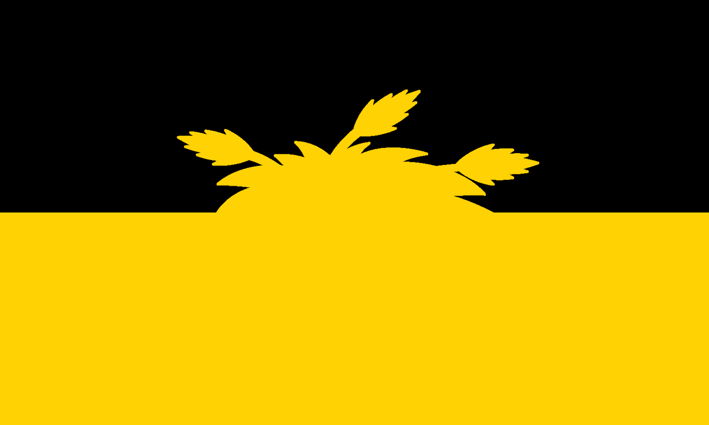
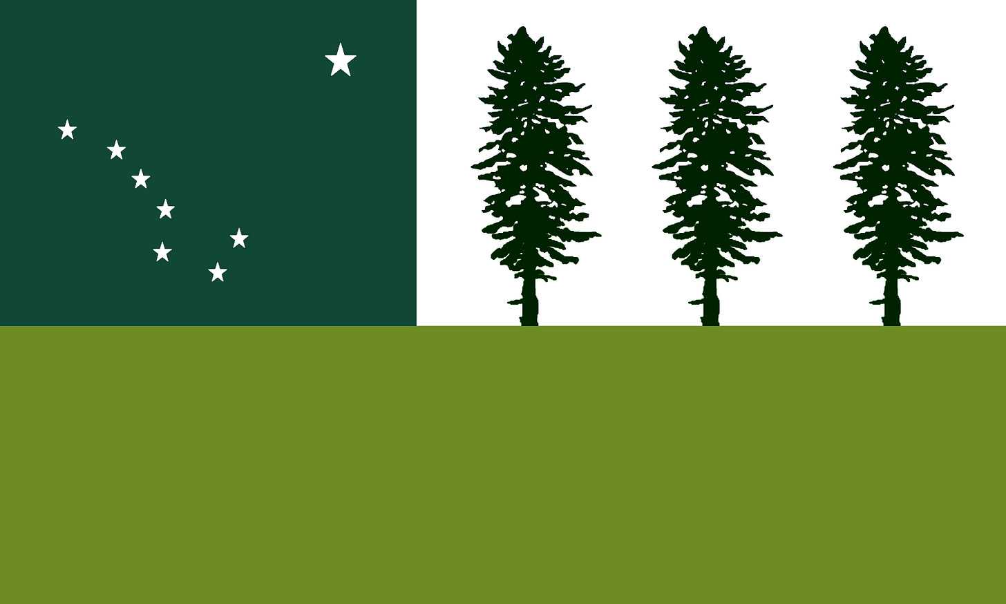
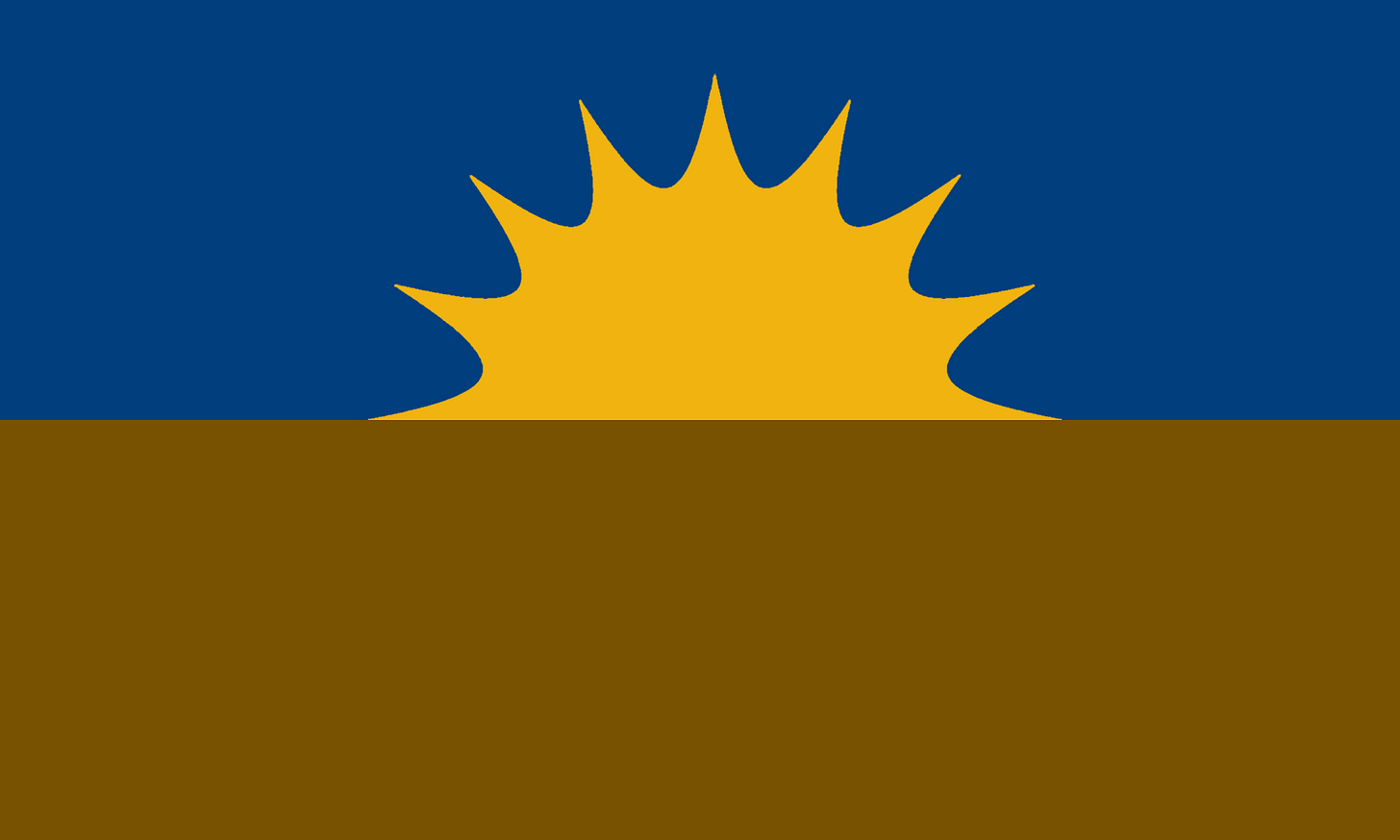
Oh, and I also made a flag for every state. They’re not very complex and I limited myself to three colors on each of them, but what kind of state doesn’t have a flag?
Without further ado, let’s go in order of population descending.
1. Morgan
Capital: New York
Population: 53,056,337
Area: 143,798 mi² (7th)
Pop. density: 368.97/mi² (3rd)
Division I institutions: 63 (61 discounting Hartford and St. Francis Brooklyn)
Representatives: 70
2020 election margin: Biden +20
Morgan gets pretty much the entire Northeast to itself. It’s the most populous state by a mile, deeply urban and blue with some red patches in the rural outskirts. It’s the Secret State equivalent of California.
For most states, the capital is the city that hosts the Secret State school. For Morgan and Coppin, it can’t be, so the honors went to the most populous city in each state. Here, that’s New York, though Philadelphia and Boston fought them over it for some time. As a compromise, symbolism from all three regions was included on their mess of a flag.
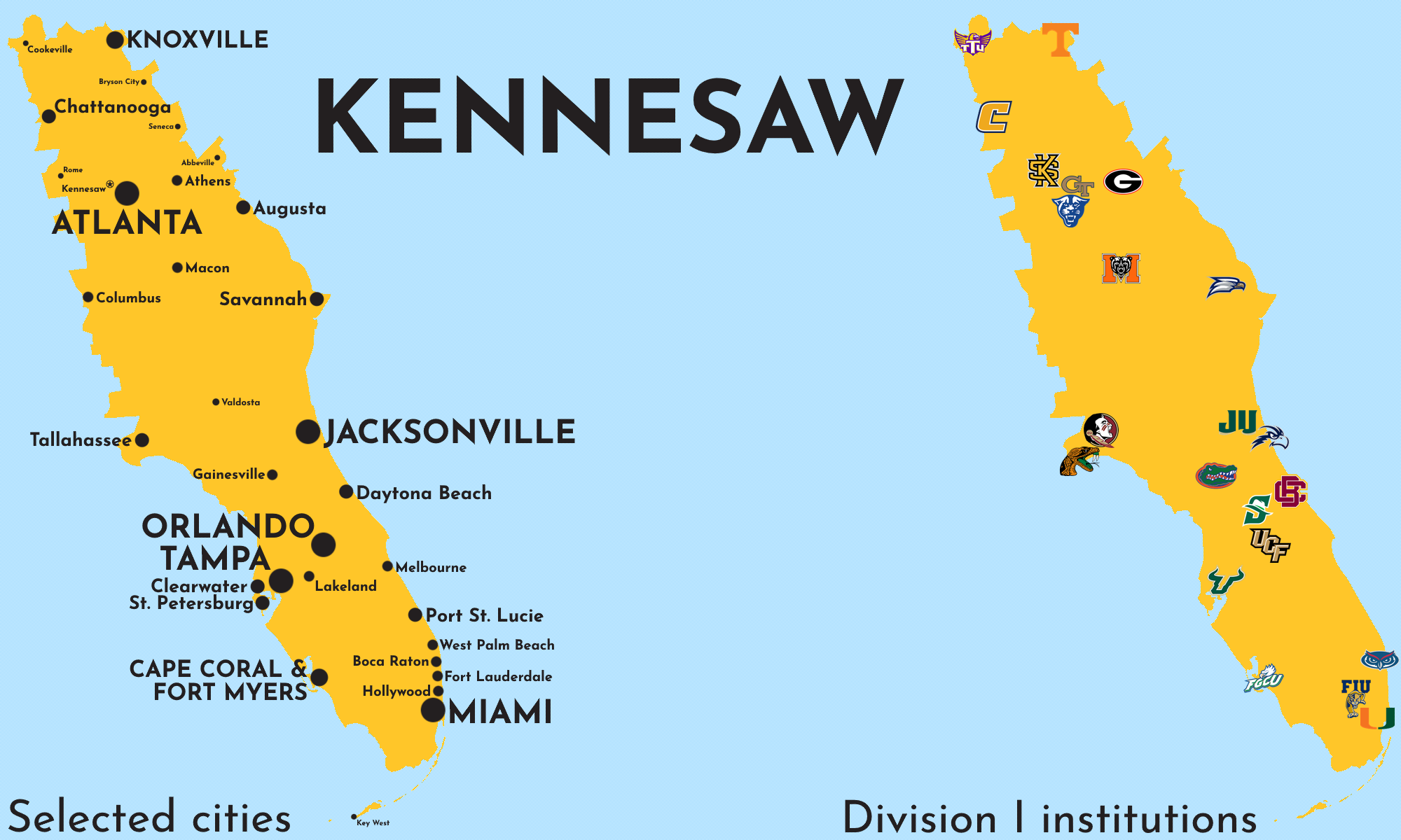
2. Kennesaw
Capital: Kennesaw
Population: 32,808,007
Area: 111,426 mi² (8th)
Pop. density: 294.44/mi² (6th)
Division I institutions: 22
Representatives: 43
2020 election margin: Trump +3
In U.S. terms, Kennesaw covers most of the Eastern Time portion of Florida, almost all of Georgia, most of East Tennessee,4 and trace amounts of the Carolinas. It's a beautiful and geographically diverse state, stretching from the Smokies to South Beach, and it has its fair share of major cultural centers.
3. Chicago
Capital: Chicago
Population: 28,088,311
Area: 260,445 mi² (4th)
Pop. density: 107.85/mi² (15th)
Division I institutions: 22
Representatives: 37
2020 election margin: Biden +9
Chicago takes most of the Upper Midwest and all of Lake Michigan; its flag depicts its land area being split in two by this Great Lake near the eastern edge, with the “four stars” motif pulled from the flag of the City of Chicago and reimagined in the shape of the North Star because I’m Minnesotan.
This state has a rich history of industry, and labor is powerful here relative to elsewhere in the country, even in some rural areas (notably the Iron Range in what we currently know as northern Minnesota). Owing to this, Chicago is solidly blue.
4. Northwestern
Capital: Natchitoches
Population: 27,172,197
Area: 154,613 mi² (6th)
Pop. density: 175.74/mi² (11th)
Division I institutions: 25
Representatives: 36
2020 election margin: Trump +4
Northwestern University is often ribbed for not being in any way northwestern: not within its country, its state, or even its city.5 Northwestern State University is at least in the northwestern part of its real-life state of Louisiana. It is not in the northwestern part of the Secret State of Northwestern, which itself is in the very southern portion of the country. Now nothing named “Northwestern” makes sense. We did it!
The state itself is essentially just metro Texas with some western Louisiana tacked onto it. Texas didn’t want to give up their flag, so it stayed. And, as with real-life Texas, the electoral votes in this state might have gone the other way in 2020 if the Rio Grande Valley didn’t suddenly flip on its head.
5. Wichita
Capital: Wichita
Population: 21,271,916
Area: 653,801 mi² (2nd)
Pop. density: 32.54/mi² (25th)
Division I institutions: 23
Representatives: 28
2020 election margin: Trump +20
Wichita is the Great Plains. Its western bounds stop just short of the Rockies, its southeastern bounds stop just short of metro Texas, and its northeastern bounds stop just short of the Northwoods of the Upper Midwest.
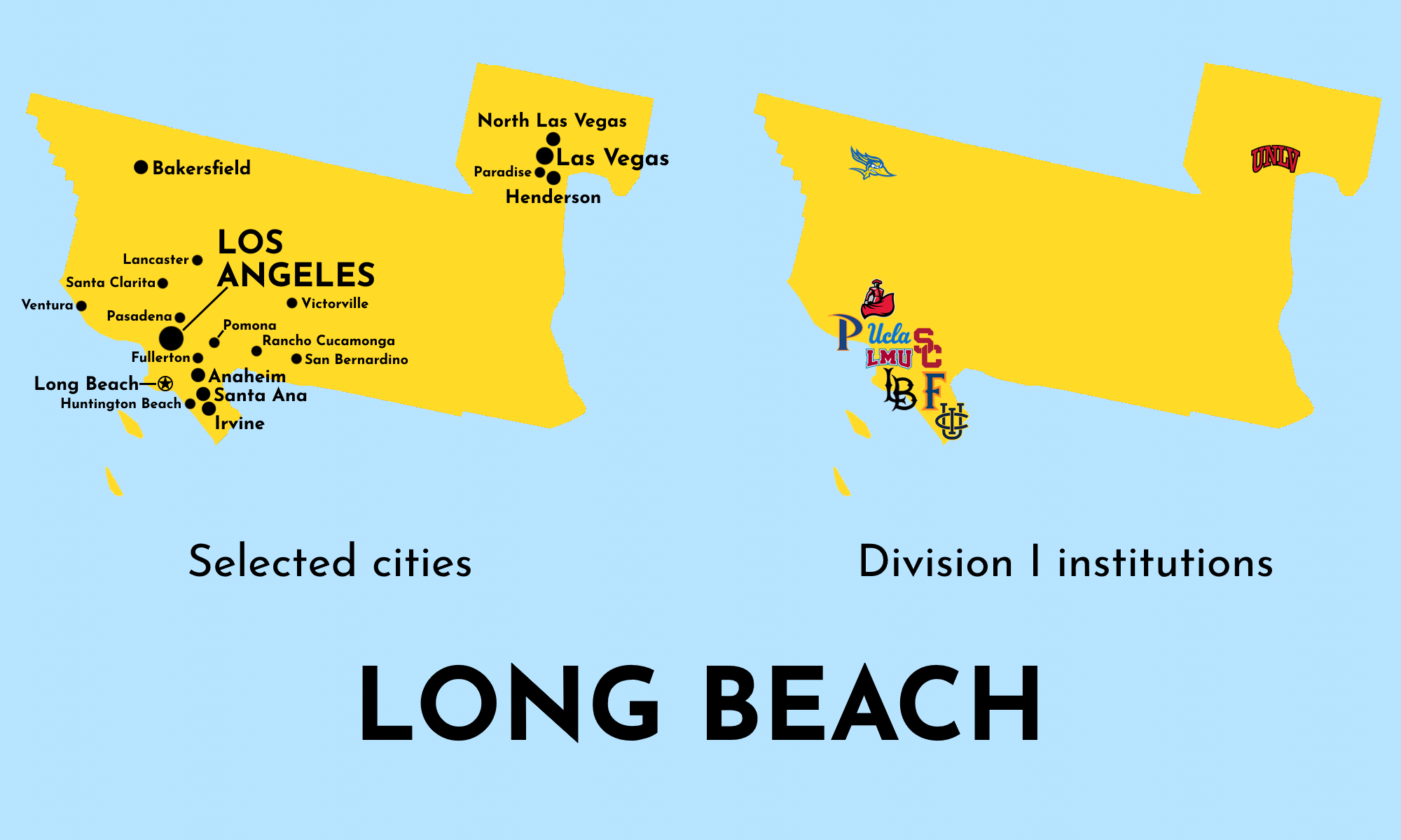
6. Long Beach
Capital: Long Beach
Population: 19,401,191
Area: 42,969 mi² (17th)
Pop. density: 451.52/mi² (2nd)
Division I institutions: 10
Representatives: 25
2020 election margin: Biden +27
This is largely Los Angeles’ state, as evidenced by its flag being the Los Angeles flag recolored to symbolize (from left to right) the ocean, the beach, and the city. We can’t ignore Las Vegas, but we will ignore that most of their economy hinges on them being located in the real-life state of Nevada and just assume they’re still allowed to be the nation’s leading hub for debauchery.
7. Appalachian
Capital: Boone
Population: 14,004,059
Area: 80,590 mi² (11th)
Pop. density: 173.77/mi² (12th)
Division I institutions: 30
Representatives: 18
2020 election margin: Trump +13
Appalachian is somewhat of a misnomer, as despite much of the state being in the Appalachians, just as much of it is in the Piedmont.6 Perhaps a more fitting name for this state would be Carolina, as it includes most of the U.S.'s South Carolina and the majority of North Carolina while also housing both of their flagship universities.
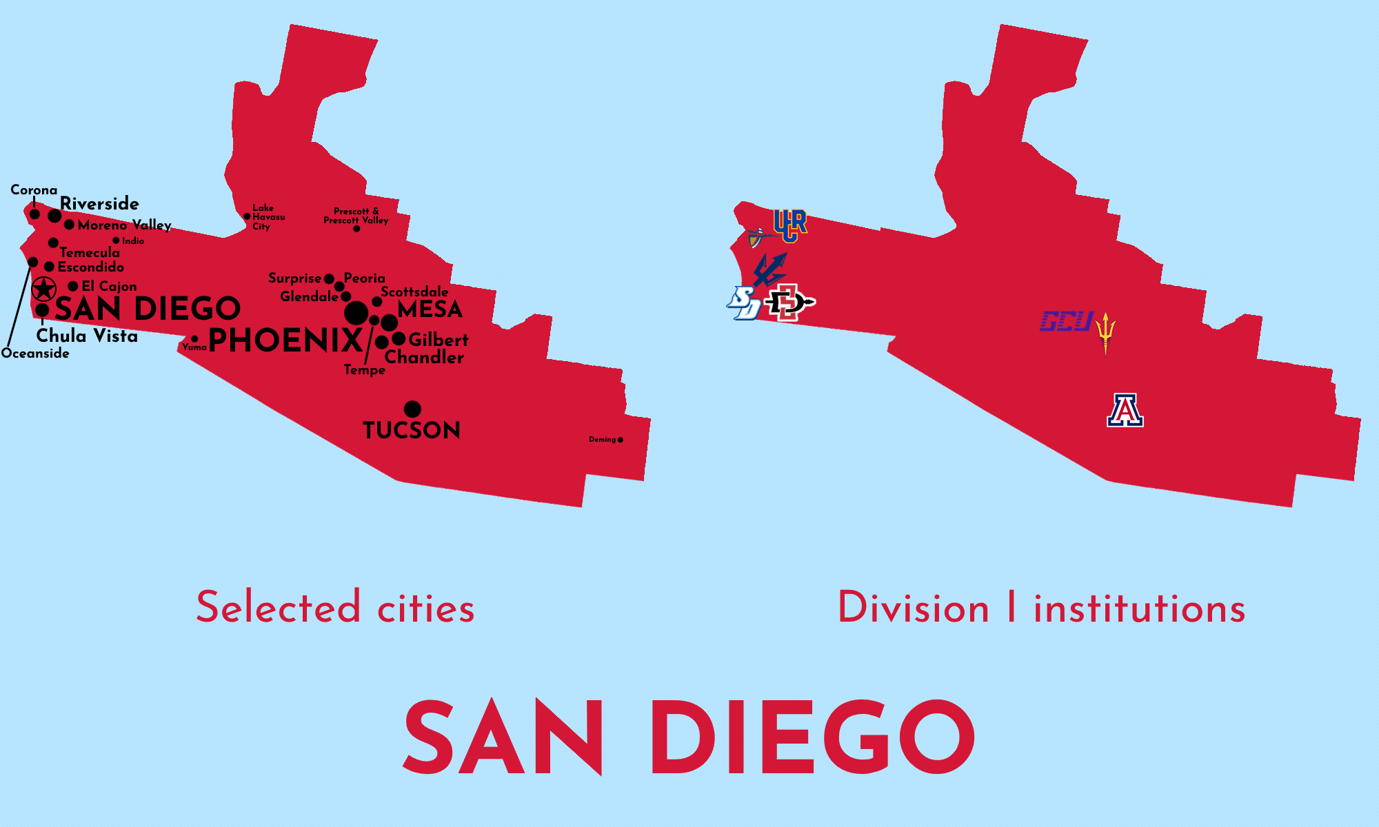
8. San Diego
Capital: San Diego
Population: 12,787,974
Area: 100,123 mi² (9th)
Pop. density: 103.69/mi² (14th)
Division I institutions: 8
Representatives: 17
2020 election margin: Biden +7
Because of how fragmented real-life California is on this map, the city of San Diego almost seems like an afterthought in its own state, which expands east into the Sonoran Desert and the Valley of the Sun. The metro areas here are too sprawled to be deep blue but the state still shows a clear Democrat lean.
Grand Canyon University is not close to the Grand Canyon, but in the U.S., it’s at least in the same state. Not here.
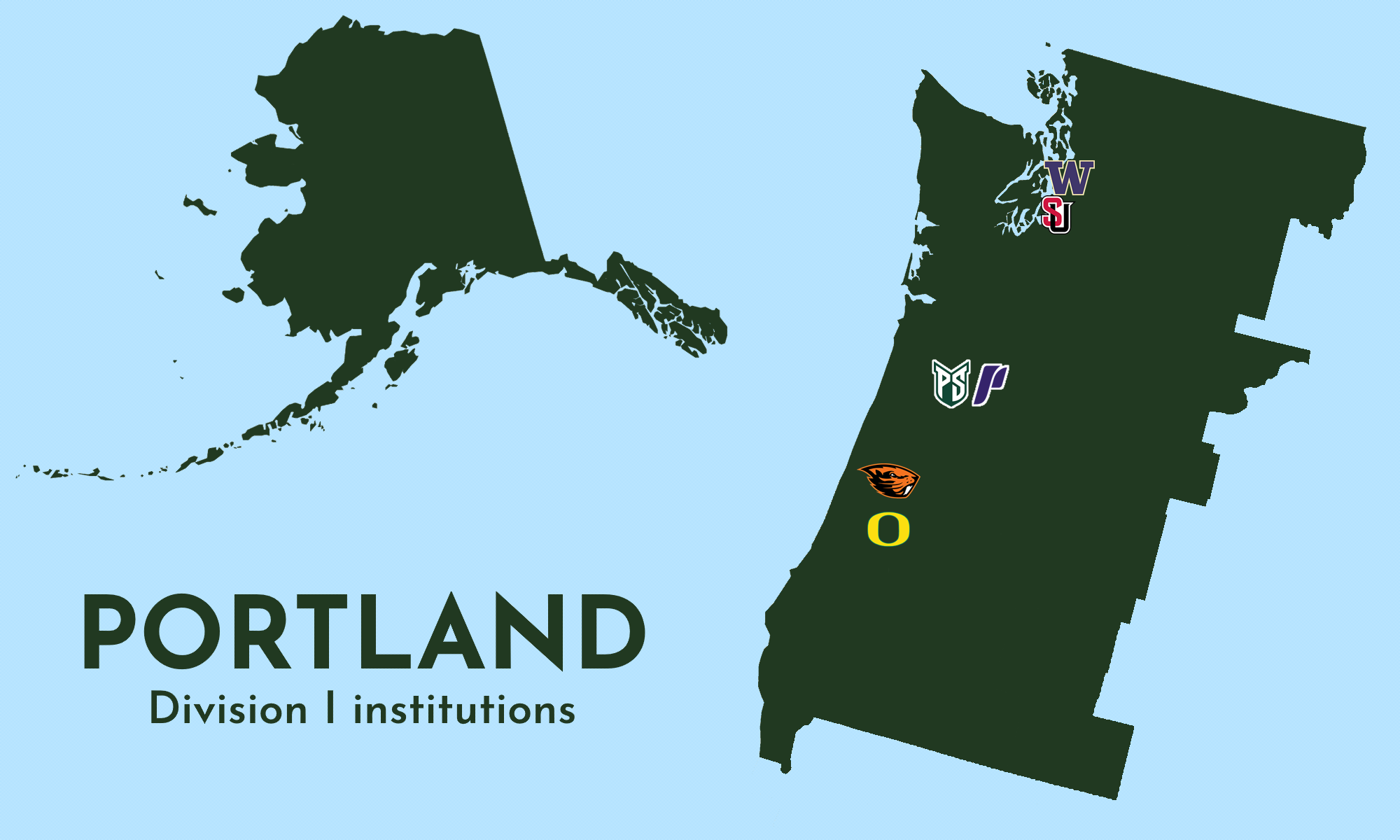
9. Portland
Capital: Portland
Population: 11,757,288
Area: 682,752 mi² (1st)
Pop. density: 17.22/mi² (27th)
Division I institutions: 6
Representatives: 15
2020 election margin: Biden +19
The Secret State with Alaska was the only one I had to split into two maps. Figures. This state is basically Cascadia. That about sums it up.
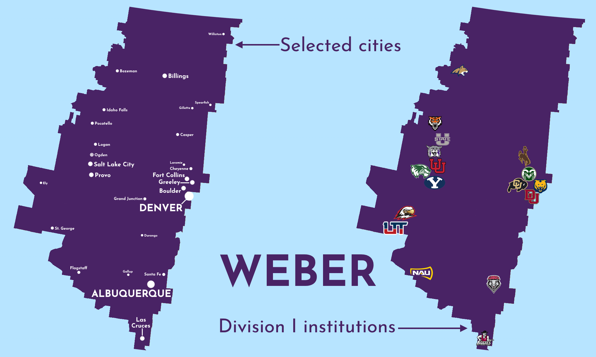
10. Weber
Capital: Ogden
Population: 10,384,287
Area: 495,071 mi² (3rd)
Pop. density: 20.98/mi² (26th)
Division I institutions: 17
Representatives: 14
2020 election margin: Trump +1
Weber’s gotta be the most scenic state in the new union; most of its land area belongs to the Rockies and it houses several beautiful National Parks, including the Grand Canyon. It’s also the swingiest Secret State despite including the entirety of real-life Wyoming and most of real-life Montana.
11. Coppin
Capital: Washington
Population: 9,914,399
Area: 27,566 mi² (25th)
Pop. density: 359.66/mi² (4th)
Division I institutions: 11
Representatives: 13
2020 election margin: Biden +27
Outside of Washington, which has too many official buildings not to be the capital of something, Coppin mostly fills the oft-forgotten hills between the East Coast and the Midwest.
12. San José
Capital: San José
Population: 9,467,521
Area: 16,789 mi² (27th)
Pop. density: 563.91/mi² (1st)
Division I institutions: 7
Representatives: 12
2020 election margin: Biden +49
What do you get when you turn the Bay Area into its own state and also give it Hawai’i? The deepest blue Secret State and also probably the richest.
13. Murray
Capital: Murray
Population: 9,321,257
Area: 89,892 mi² (10th)
Pop. density: 103.69/mi² (17th)
Division I institutions: 18
Representatives: 12
2020 election margin: Trump +20
As displayed on their flag, Murray is powered by river towns, especially on the Ohio River. And with both Nashville and St. Louis in its limits, Murray has no shortage of excellent music.
14. Cleveland
Capital: Cleveland
Population: 8,578,408
Area: 30,009 mi² (23rd)
Pop. density: 285.86/mi² (7th)
Division I institutions: 5
Representatives: 11
2020 election margin: Biden +9
Just as the U.S. state of Michigan is split in two, so too is the Secret State of Cleveland. But in this case, instead of being split up by a majestic Great Lake, it’s split up by…Toledo. Nevertheless, the Rust Belt lives on in Cleveland.
15. Ball
Capital: Muncie
Population: 7,642,207
Area: 37,194 mi² (20th)
Pop. density: 205.47/mi² (8th)
Division I institutions: 11
Representatives: 10
2020 election margin: Trump +12
The Secret State of Ball is essentially just real-life Indiana extended somewhat north-south. It’s the Crossroads of America. And with these borders, we can finally stop pretending Louisville is in the South.
16. Youngstown
Capital: Youngstown
Population: 7,331,724
Area: 41,208 mi² (19th)
Pop. density: 177.92/mi² (10th)
Division I institutions: 10
Representatives: 10
2020 election margin: Trump +9
Oh hey, we can also stop pretending Pittsburgh isn’t in the Midwest. (Our own
has always thought Buffalo is a Midwestern metropolis.)17. Norfolk
Capital: Norfolk
Population: 7,244,403
Area: 41,947 mi² (18th)
Pop. density: 172.70/mi² (13th)
Division I institutions: 13
Representatives: 10
2020 election margin: Biden +9
I put real effort into this flag because, at the time of this writing, I live here. Like the Secret State it represents, it combines elements from the flags of the Tidewater region and that of the City of Raleigh.
The Carolina-Duke rivalry gets split between Appalachian and Norfolk despite the two schools being located eight miles away from each other in adjacent counties.
18. Wright
Capital: Dayton
Population: 6,598,198
Area: 19,210 mi² (26th)
Pop. density: 343.48/mi² (5th)
Division I institutions: 9
Representatives: 9
2020 election margin: Trump +8
The State of Wright continues to claim they’re the birthplace of aviation despite the plane their flag depicts first being flown in the State of Norfolk.
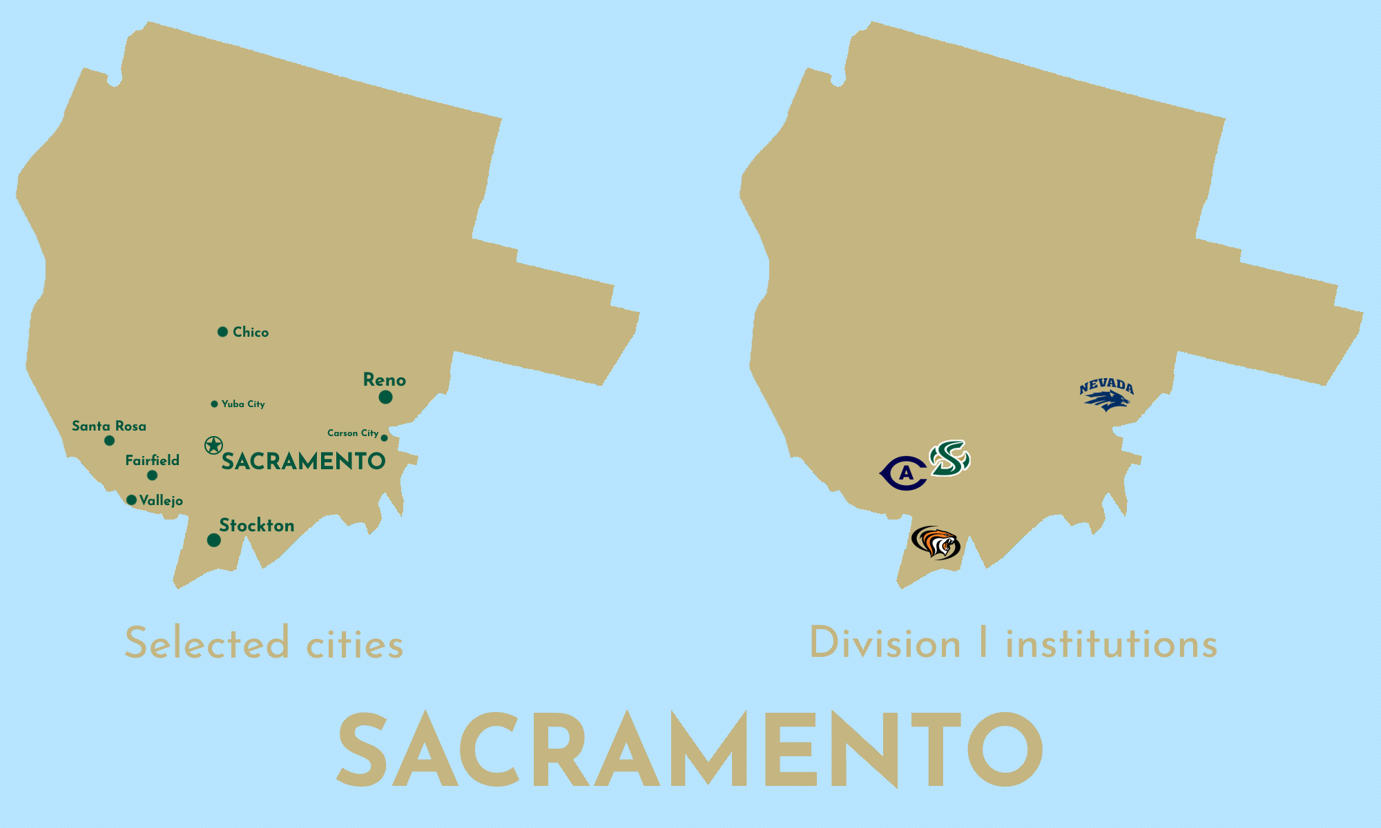
19. Sacramento
Capital: Sacramento
Population: 6,164,023
Area: 68,337 mi² (13th)
Pop. density: 90.20/mi² (19th)
Division I institutions: 4
Representatives: 8
2020 election margin: Biden +14
Sacramento is essentially real-life NorCal. And because it expands eastward into the Great Basin, its outline looks like a face! In our world, Michiganders can tell people where they live by pointing to a spot on their hand; in this one, people could tell you they live in Susanville by poking themselves in the eye.
20. Jacksonville
Capital: Jacksonville (no, the other one)
Population: 5,507,772
Area: 56,262 mi² (14th)
Pop. density: 97.89/mi² (18th)
Division I institutions: 8
Representatives: 7
2020 election margin: Trump +30
What the Secret State of Ball is to the U.S.’s Indiana, the Secret State of Jacksonville is to the U.S.’s Alabama.
This is also the only Secret State to claim a county7 that isn’t contiguous with the rest of its land. It isn't the only Secret State with an exclave; some land in Arapahoe County, Wichita, is completely surrounded by the consolidated city-county of Denver, Weber.
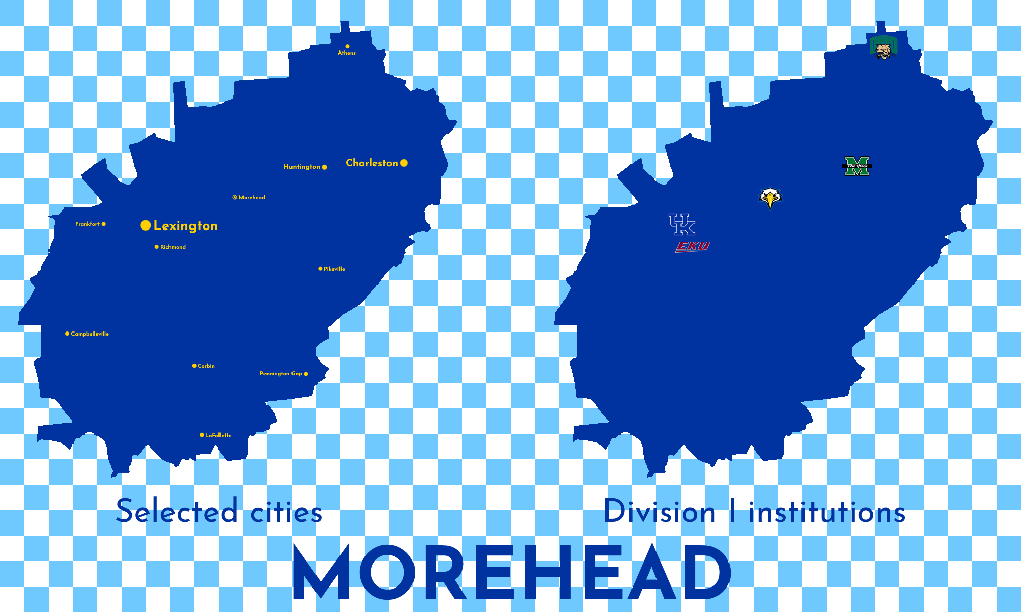
21. Morehead
Capital: Morehead
Population: 3,081,924
Area: 35,944 mi² (21st)
Pop. density: 85.74/mi² (21st)
Division I institutions: 5
Representatives: 4
2020 election margin: Trump +38
Morehead is pretty analogous to real-life West Virginia: Appalachian mountainous, deeply red (the deepest red Secret State), and sharing much of the same culture because they take up much of the same area. They’re even kinda shaped the same way.
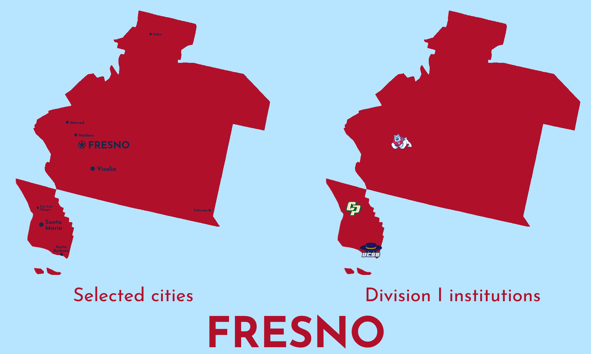
22. Fresno
Capital: Fresno
Population: 3,048,954
Area: 71,625 mi² (12th)
Pop. density: 42.57/mi² (24th)
Division I institutions: 3
Representatives: 4
2020 election margin: Biden +5
The main landmass of Fresno is just barely contiguous with the two counties to the southwest, but there’s no road that links the two areas without dipping into Long Beach to the south or San José to the west.
Fresno is the least populous Secret State that voted for Biden in 2020.
23. Alcorn
Capital: Lorman
Population: 3,027,269
Area: 28,995 mi² (24th)
Pop. density: 104.41/mi² (16th)
Division I institutions: 7
Representatives: 4
2020 election margin: Trump +10
As a condition of joining the great Secret State of Alcorn, every sports team must redesign their logo to look like Alcorn State’s mid-aughts 3D WordArt.
24. Boise
Capital: Boise
Population: 3,005,285
Area: 197,151 mi² (5th)
Pop. density: 15.24/mi² (28th)
Division I institutions: 6
Representatives: 4
2020 election margin: Trump +20
Hey, would you look at that: now we can also stop pretending Boise is in the Pacific Northwest! Did I rig this whole map to suit my own personal U.S. geography takes? You can’t rule it out!
It’s also worth noting that Boise is even less dense than Portland, which includes the entirety of Alaska. There is no one in the wide majority of this state.
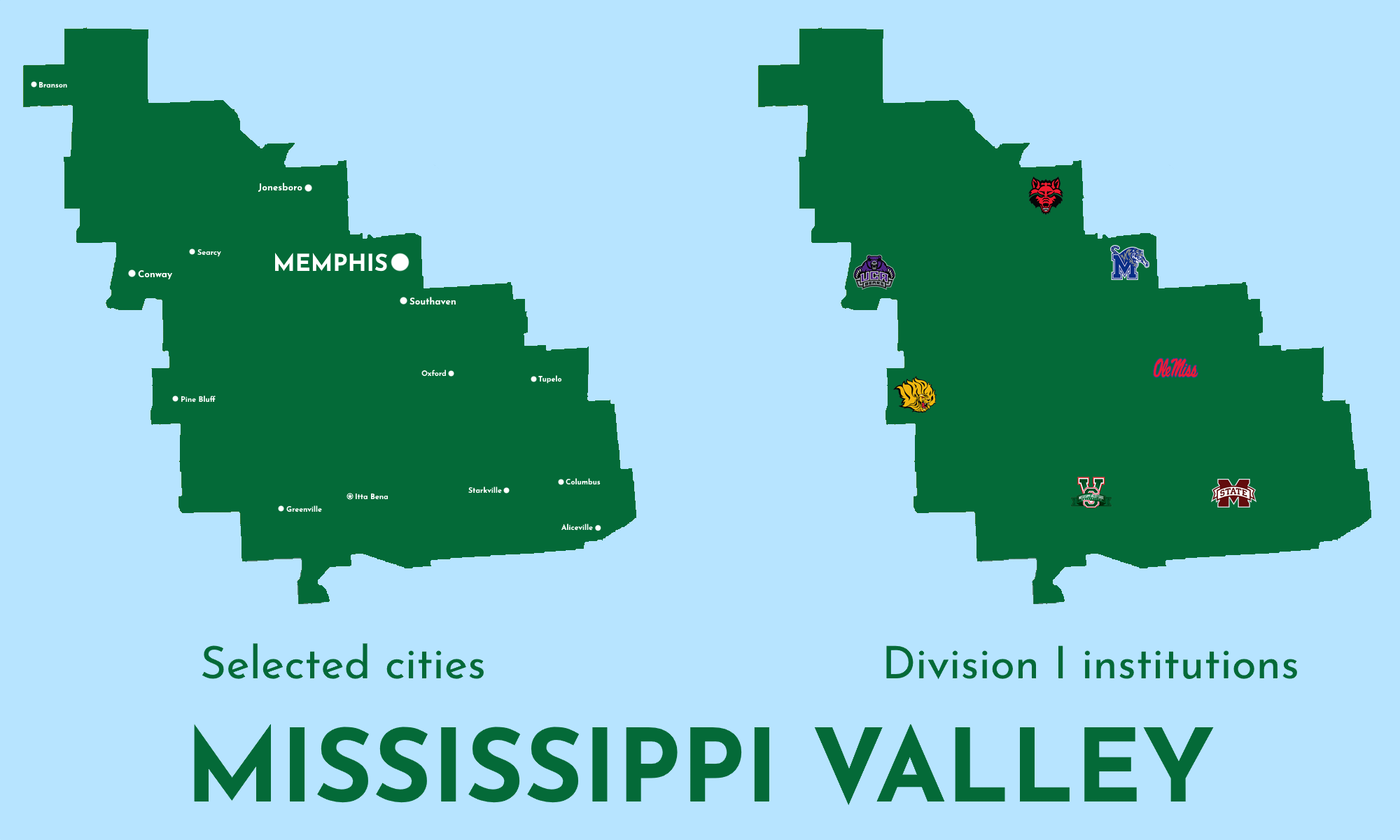
25. Mississippi Valley
Capital: Itta Bena
Population: 3,003,942
Area: 46,297 mi² (15th)
Pop. density: 64.88/mi² (22nd)
Division I institutions: 7
Representatives: 4
2020 election margin: Trump +8
The Secret State of Mississippi Valley takes just one county from real-life Tennessee, but it gives them their largest city and prevents them from being completely forgotten.
26. Jackson
Capital: Jackson
Population: 2,782,232
Area: 31,722 mi² (22nd)
Pop. density: 87.71/mi² (20th)
Division I institutions: 3
Representatives: 4
2020 election margin: Trump +21
Jackson hosts most of the population centers along the northern Gulf Coast. In the southwest corner, Hancock County and St. Bernard Parish share a maritime border, but you’d have to drive through Alcorn to get from one to the other on land.
27. Grambling
Capital: Grambling
Population: 2,308,111
Area: 45,624 mi² (16th)
Pop. density: 50.59/mi² (23rd)
Division I institutions: 4
Representatives: 3
2020 election margin: Trump +31
The best thing to come out of this border redraw: now Lafayette has nothing left to lord over Monroe. Neither of them can be the real Louisiana because “Louisiana” does not exist.
28. Kent
Capital: Kent
Population: 2,104,377
Area: 10,248 mi² (28th)
Pop. density: 205.34/mi² (9th)
Division I institutions: 2
Representatives: 3
2020 election margin: Trump +20
Last, but not least, it’s Kent: home of LeBron James and the Pro Football Hall of Fame. Just two Division I institutions here, but boy, do they hate each other’s guts.
And we can’t forget Baltimore!
Capital: Baltimore
Population: 585,708
Area: 92.05 mi²
Pop. density: 6,362.93/mi²
Division I institutions: 3
Representatives: 0
2020 election margin: Biden +77
Yep, it’s Baltimore!
2020 Presidential Election
So, in this Secret State universe, assuming every vote in the 2020 Presidential Election was cast the same way it was in the real U.S. universe, who would be the President right now?
In my fantasy land, the Electoral College doesn’t exist, but let’s assume it still does here and the rules surrounding it are the same: every state gets one elector for every Representative they have plus two (one for each Senator). The capital district gets the same number of electors it would have if it was a state or the same number of electors as the least populous state, whichever is lower. In this case, the former number (3) is lower than the latter (5), so they get three electors.
This gives us 494 electors in all, not 538. This is intuitive; we have the same number of Representatives, but we have just 28 states, not 50, and the capital district has the same number of electors as it does in the U.S., so all we’re really doing is subtracting 44 Senators.
Do all those calculations, put ‘em on a nice shiny map, and you have your winner. The President of the Secret States is:
Well, crap.
Okay, how do we break a tie? In the U.S., the President would be decided by a vote of one House of Representatives delegate from each state, with each state logically sending a member who represents their majority party.
Thing is, we don’t actually know the majority parties for each Secret State in the House of Representatives because, while I did have a lot of time on my hands, I didn’t go to the trouble of trying to draw actual district boundaries for every state; that’d be absurd. Even if I did, how do we decide which candidates each electorate is voting for? We can’t. It’s an impossible exercise.
So who’s the actual President of the Secret States? We have no surefire way of knowing. So guess what? It’s you!
Or county equivalent, as in Alaska (boroughs), Connecticut (councils of governments, which are in the process of replacing counties as of this writing), and Louisiana (parishes)
Geography nerd nitty gritty stuff: this was done using a Voronoi diagram / Thiessen polygons in QGIS.
I pulled the county-level vote totals for every state and reapplied them to the Secret States as necessary.
But not the part of East Tennessee with East Tennessee State University
Most of the Midwest was known as the Northwest Territory from 1787 to 1803, including all of present-day Illinois, where Northwestern University was founded in 1851.
Kind of like how Montana is named after the Spanish word for “mountain” despite the wide majority of its land being high plains.
Jackson County, real-life Tennessee



















Also, it's funny that Duke and Carolina are in separate states. It must be fate.
lmaoo i can't believe the election ended up being a tie